Você está no 3DFinder
Buscamos em Thingiverse, MakerWorld e Printables ao mesmo tempo para te dar o melhor de cada uma.
Descrição
Stratamap is a web tool that makes it easy to turn your favorite places into detailed 3D printed maps.
Personal use only. Please contact us about commercial use.
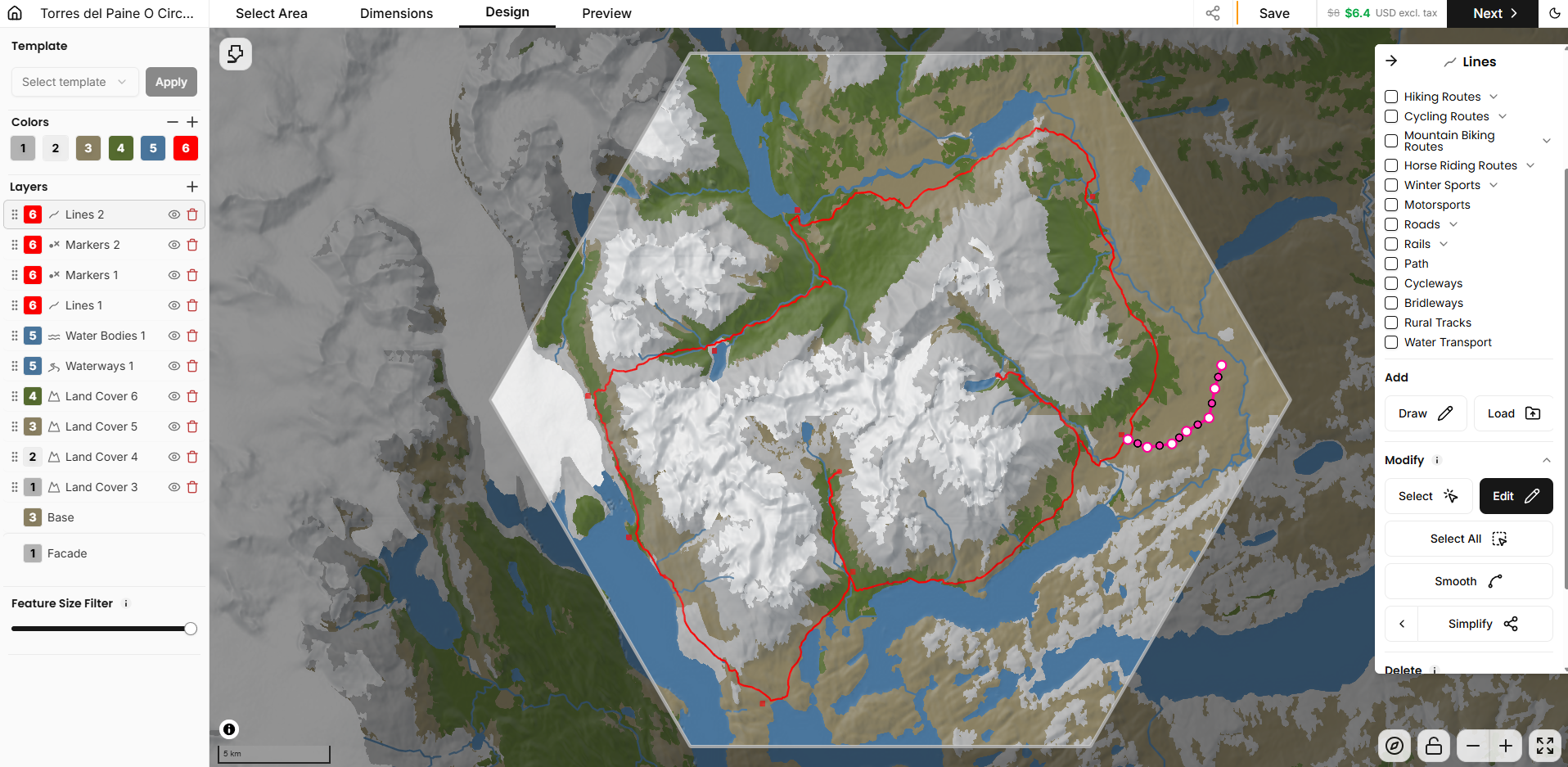
How Stratamap works
1. Select an area - Draw an outline on the map using standard or custom shapes.
2. Set your dimensions - choose the size and settings for your printer.
3. Customize your design - Add layers, colors, GPX/KML/Shapefiles, or draw your own features.
4. Export and print - Download print-optimized meshes with a separate STL for each color.
Key features
- Quality files optimized for your printer, generated layer by layer to for consistent, reliable prints. With separate STL files for each color.
- Advanced visual editor, edit your trails, markers, coloring and more, allowing you to draw, upload and smooth features.
- Detailed terrain and color data, specially refined for maps of any scale. With global coverage and granular control.
- Save, duplicate, and iterate on your designs in your account.
- Share your designs with friends and the community using a share link.
Get started
- Start your first project at: stratamap.io
- First map is free!
- Afterwards it is pay per map (print settings, scale, size are all editable after purchase for free).
Coming soon
- Larger scale maps using interlocking tiles coming soon.
Sample model - Torres Del Paine
Files are optimized for layer height and size. Download either the 0.3mm or 0.2mm layer height files, (for 240mm hexagonal shape) or edit the design using the following share link.
[https://stratamap.io/share/Qx6YPO3_YKYD](https://stratamap.io/share/Qx6YPO3_YKYD)
We would love to hear what you think of what we are building. Drop us feedback in the comments.